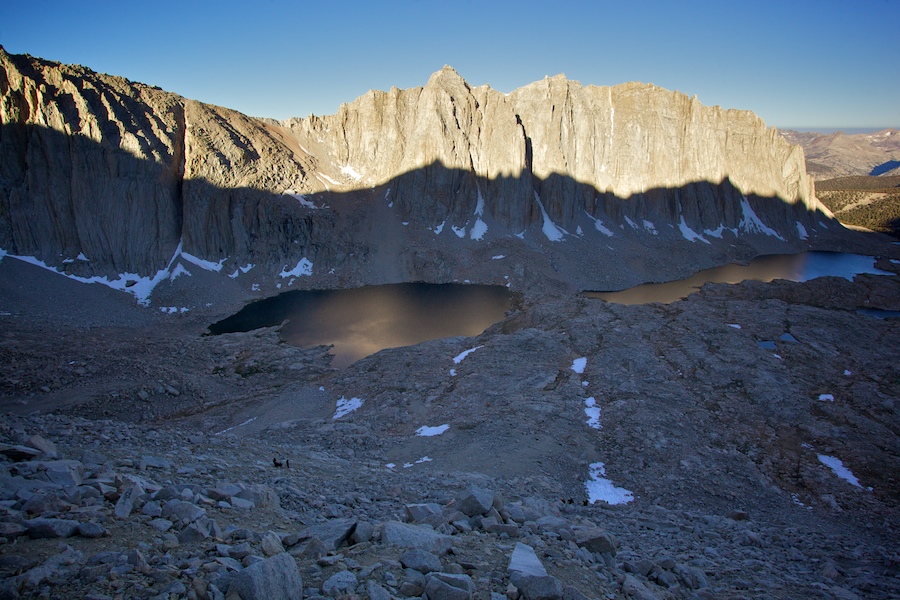
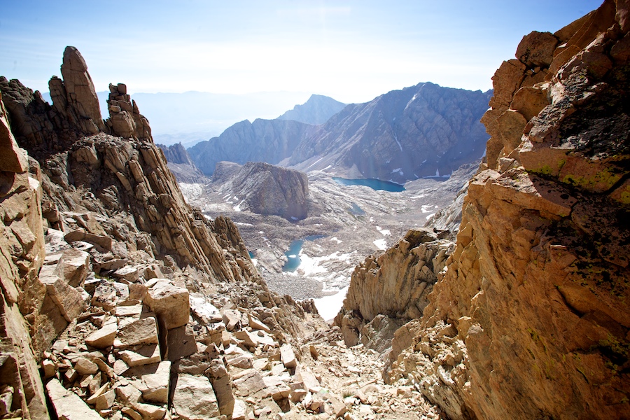
In the far off distance lies Lone Pine, the Inyo Mountain Range, and even further, Death Valley. In the near distance are the Whitney 'teeth' that the trail skirts on the way up and down. Click to zoom in.
-llg
In the far off distance lies Lone Pine, the Inyo Mountain Range, and even further, Death Valley. In the near distance are the Whitney 'teeth' that the trail skirts on the way up and down. Click to zoom in.
-llg

On this hut there was a sign, it basically outlined the proven fact that in the event of a lightening storm on the summit of Mt. Whitney, the hut would "offer you NO PROTECTION." Apparently people have died inside of the hut while others survived outside of it when lightening struck the summit...I spent very little time inside of the hut myself.
-llg

Facing East, you could see the town of Lone Pine, where we would soon be drinking and celebrating with sustenance, merriment, and cheer. Click to zoom on in.
-llg
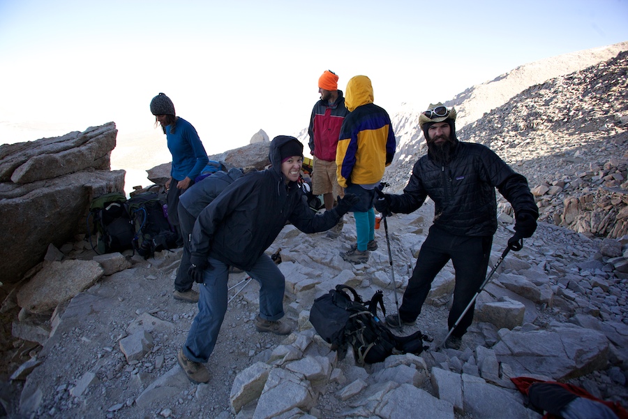
Yeah, we finished too.
-llg

Singer, songwriter, master of hip blisters. He's F'ing Ben Rouse.
-llg

California girls, generous enough to give us a ride back to San Fran, and the only man I've ever seen get a free meal out of a striptease.
-llg

Second funniest guy on the trail. Me being number one.
-llg
-llg

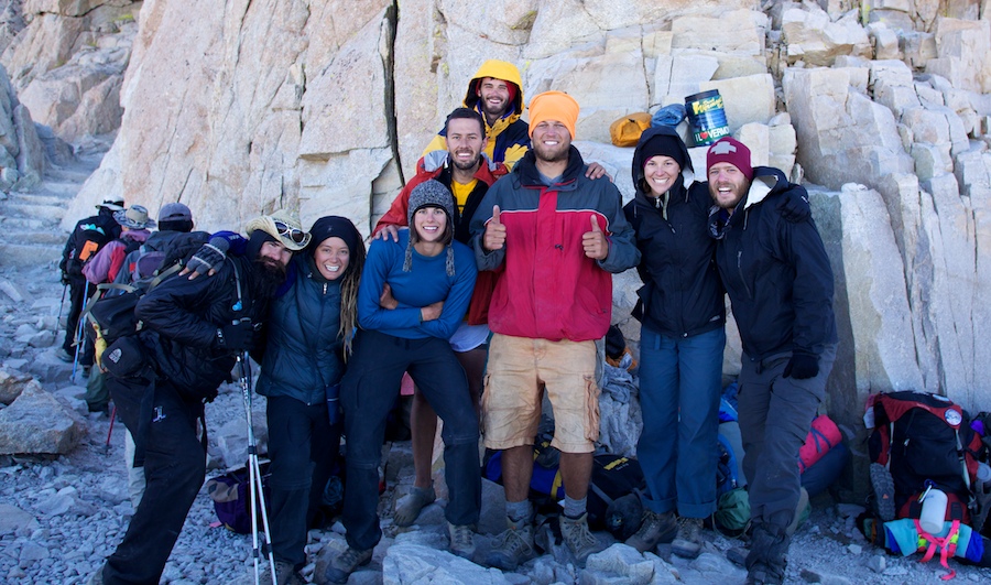
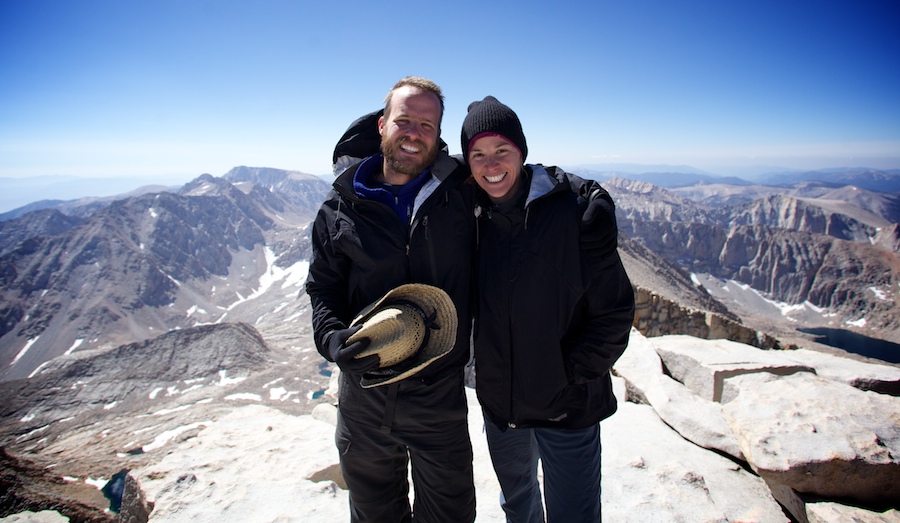
The Summit Crew, atop Mt. Whitney.
-llg
Editor's Note: The following is pulled from the journal that I kept while hiking the John Muir Trail this past month. I'll post each entry for the next few weeks. If you are just tuning in, you can go to the first day of the journal here.
August 15th, a Sunday. Now, we sit in another coffee shop, this time in Santa Cruz. Been a week since we summitted Whitney. Might as well recount that before getting into the events of the week since...
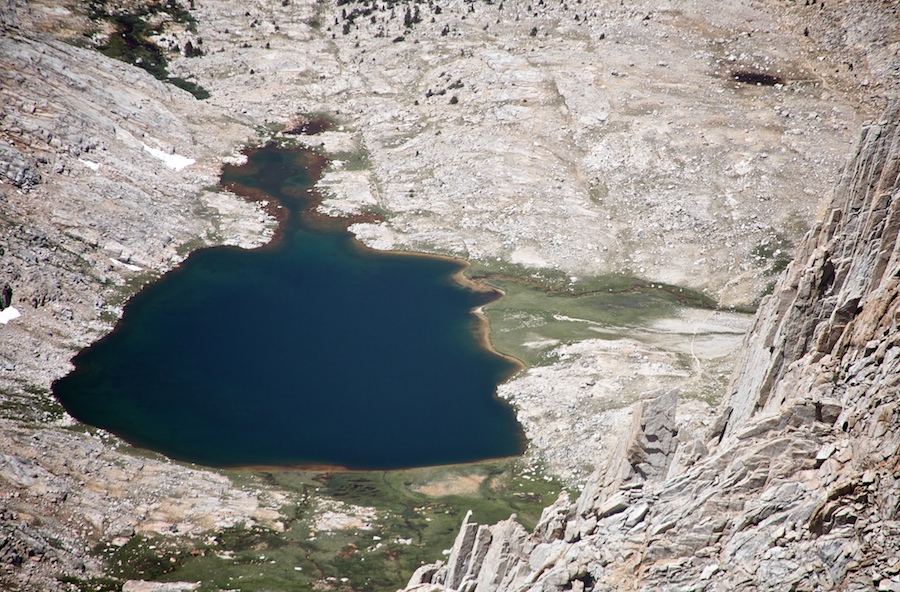
Camp at Guitar Lake was a little cold for sleeping, but good enough even with the anticipation of the next day looming. Woke at 4:45, with a few minutes to lay in bed, before waking the rest of the crew. Ate the pack of instant 'Rainier Rice' for breakfast with Bri, not a bad start to the day, but the gas was pretty bad on the climb up. I blame altitude...
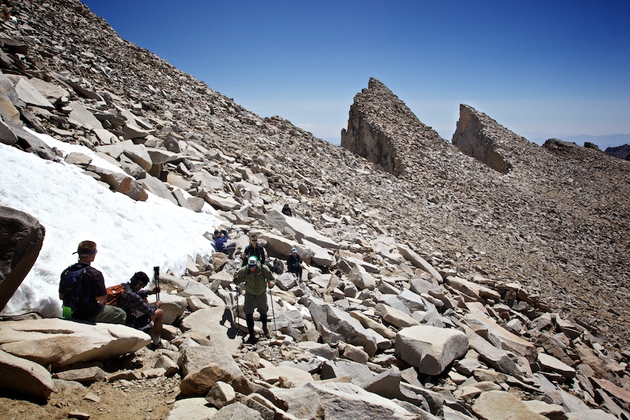
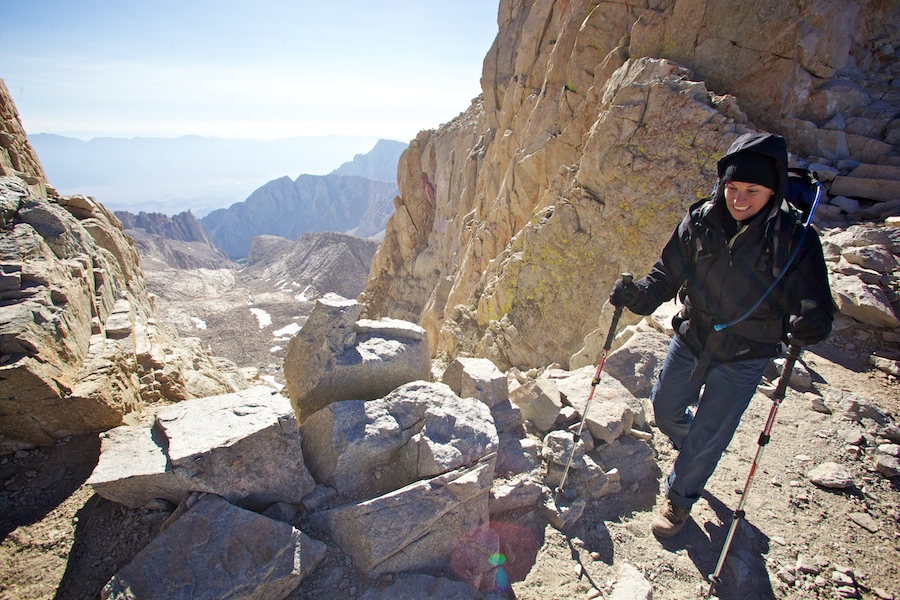
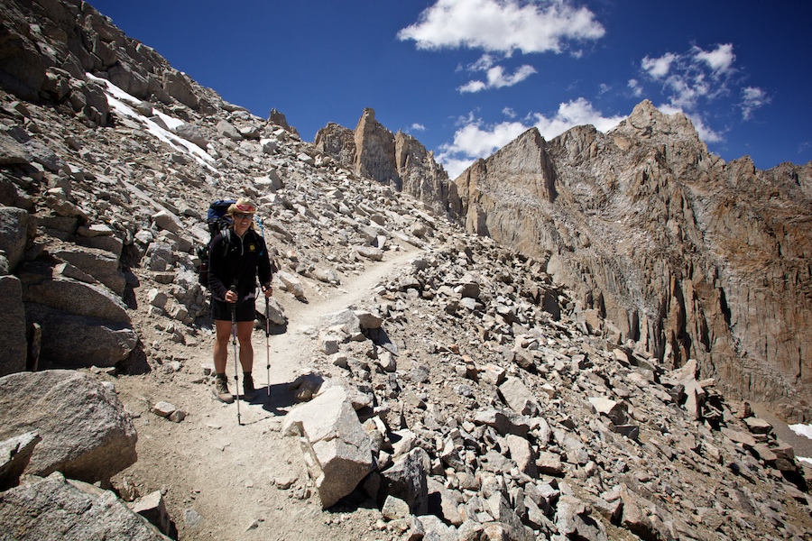
Started up the 5-mile, 3000 ft climb to the trail's end, the summit of Mt Whitney. The unending switchbacks were carved into the side of a steep, nearly vertical rock face. Slow progress up the side, with a direct line of sight to those both an hour in front of us, and an hour behind. Steady, steady uphill, strange rock formations and arrangements, and lots of huffing and puffing. Guitar Lake shrank below us, as the rocky crest that marked the highest point we could see grew closer. Suddenly we could see the trail junction at the end of a long switchback: The crossroads of our JMT and the exit/entry trail from Whitney Portal, joining together for the final 2 miles up to the summit. As we would be returning to this point after the summit, we ditched all unneeded weight in the customary fashion, aka piles of gear stashed along the rock wall.
Took up water, a few bars, all my warm layers, and all the camera gear. Pack felt strange without its usual weight and inertia, especially while turning or rotating. Though lighter in step, the air was lighter still, and the hiking was a bit spacey, as most of the oxygen I took in went right to the legs, and less to the brain. When I stopped, clarity immediately returned, but as soon as I had hiked another minute, I was a space cadet again. We skirted the western edge of the ridge, mostly shielded from sun and eastern views, and the stronger winds, except for the periodic 'Whitney Windows,' gaps in the rocks that funneled downward and exposed us briefly to the views to come at the summit.
Wasn't 10am yet, and even in the sun, it was quite cold, and I hiked in just about all my clothes for the first time on the trip. Eventually we curved a bit west and then directly east up the final prow. At the top, we found '007', our cardiologist friend that had slipped ahead when we went into Vermillion, and everyone was excited for the unexpected reunion. Once our entire crew had reached the top, we took pictures with Double-O-Seven, and shared hugs and congrats. Cookie cracked his last two Guinness as I turned on the cellphone and made calls to the family from the highest elevation in the lower 48, first cell reception since Reds Meadow. Left messages to the family, but got Pete and Joe on the line for a bit. Shared the phone with Los Tres Penitos, signed the trail register and ceiling inside Whitney Hut, then started back down. I was the last to walk off, and it was sad to be leaving such a wonderful place in such good weather.
Many shots as I headed down with Bri and Cookie, many tourists on the way up from Whitney Portal, some in great shape and smiling, some seemingly about to collapse. All of them asking, "How much further?" Cookie's canned response, no matter the actual distance: "About a mile." :)
Back down at the junction, the boys and SamAshley were finishing repacking and headed out, while we had to start over on cramming all our gear back into the packs; seemed remarkable that we had been carrying all that crap to begin with. We were officially done thru-hiking the John Muir Trail when we summitted Whitney, as that's the official southern terminus, but there was still the 10+ miles down to Whitney Portal, nearly 6500 ft below! We decided to count those 10 miles in our total, as they turned out to be pretty damn brutal. From the junction, there was actually 10 minutes of uphill to the Crest Pass, which was exhausting with the freshly loaded pack. On the other side began the 99 switchbacks down to Trail Camp, where the weekenders, the smart ones anyway, stage their summit push. This section was intensely steep, though the trail itself was reasonable. Some switchbacks were long, but some were only eight foot long before turning around again.
Seemed forever before we reached Trail Camp, still in the alpine zone, and rife with weekenders. We sat for a few minutes, Bri popped a couple Vitamin Is for her aching back, and then downward. We had originally planned on staying here on the way down, but what folly! An over-populated, sprawling campground full of all worlds of weekenders, so over-used that they removed all the composting toilets and everyone has to pack out their own poop (though not everyone abides by that rule)...and beer, burgers and all that fun just a few more miles down the mountain?!? Hardly the choice for a ravenous thru-hiker. We didn't even want to stop to eat the last few granola bars we had, not with a burger at the base of the trail. Ran out of water, but didn't want to stop and pump, not with a BEER at the base of the trail. And though 5 pm seemed far off enough, we wanted to make sure we got to Whitney Portal before then in case the cafe closed at 5. After never-ending descent, we glimpsed the road far below, still an hour away. No rest, just fast downhill shuffling. The steep switchbacks from earlier were now replaced by ridiculously long, nearly level trail that cut across the slope, frustratingly slow in their approach, though I suppose a good way to start out for those headed to Whitney from lower elevations. By the way, never, EVER, hike Whitney from the Portal side! What a brutal hike it would be! Met some idiots here and there just setting out ands asking, 'How much further?' Uh, like 6 hours for you dude, if you don't stop. Behind us, the summit was slowing becoming encased in dark, wet-looking clouds. 007 told one guy (with a bottle of water in his hand) flat out, DO NOT keep going. Indeed, though we only had a bit of a cold sprinkle as we finished the last mile, we heard later that it was snow and hail up at the summit and Trail Camp that afternoon!
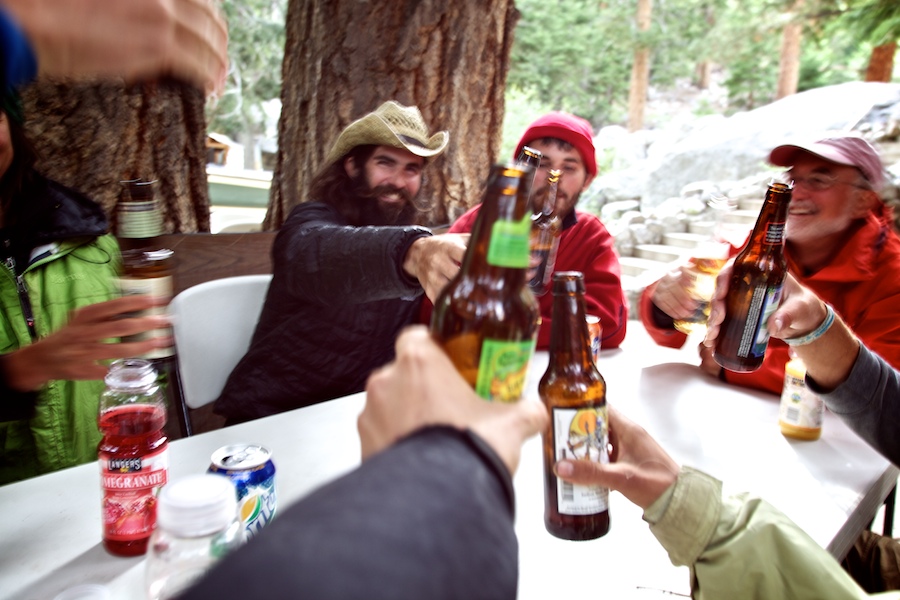
At the bottom, the crew was waiting. I weighed my pack, 43 lbs. with no water and no food. On to the cafe, beers and burgers as promised. We debated the stay in camp, but with Lone Pine only a 12-mile hitch away, we all decided to head down. I called five hotels before we found the last room in little Lone Pine, which happened to have four beds, enough for everyone in our 8-person crew. Bri and I were the last to catch a hitch out of the parking lot, but it didn't take long, and soon we were flying though the Alabama Hills to the western town of Lone Pine, where they filmed countless westerns and sci-fiction flicks since Hollywood's inception. Ice cream, showers, beers, Irish Whiskey. Talked to Natalie on the phone, soon it was dark. Thought we might all crash, but the whole lot rallied to the 'Double L,' the local bar, for beer, cocktails, pool, and dancing to the jukebox. Got pretty good and sauced. We shut the town down that night, not without first shambling down the streets in a vain search for food, then we all crashed back at the hotel.
-llg
Editor's Note: The following is pulled from the journal that I kept while hiking the John Muir Trail this past month. I'll post each entry for the next few weeks. If you are just tuning in, you can go to the first day of the journal here.
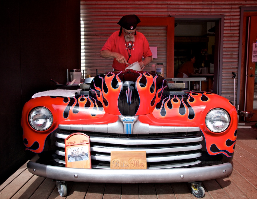
Thursday, August 12th - Skipped quite a few days there! Strange as it sounds, no time for writing. Too much socializing, partying, celebrating. Currently I'm writing in a cafe, outdoors, in Monte Rio, a few clicks east of the Pacific Ocean and Hwy 1. DON'S DOGS, home of the bacon-grease powered Ford Grill. Spent last night in a very different campground, on the coast, RVs everywhere, stereos and DVD players in the tents around us...a long way from the Sierras, and our hiking home in the back country. Uh oh, here come my buckwheat pancakes, hot off the Ford...to be con't...
-llg

The night before our final push, and the weather finally looks like it's going to back up its bravado...
-llg

And another zoomable panoramic to complete the day.
-llg

Couldn't resist a high contrast treatment of this azure blue sky, tree and cloud. You can acheive the black sky with high contrast black and white film, and a dark red filter, which blocks all the blue wavelengths coming into the lens. For digital, the same principle applies. Reduce the blue channel in the image, remove that data, and the sky goes dark. Add some contrast, and viola! A larger violin.
-llg

More strangeness on the Bighorn Plateau.
-llg

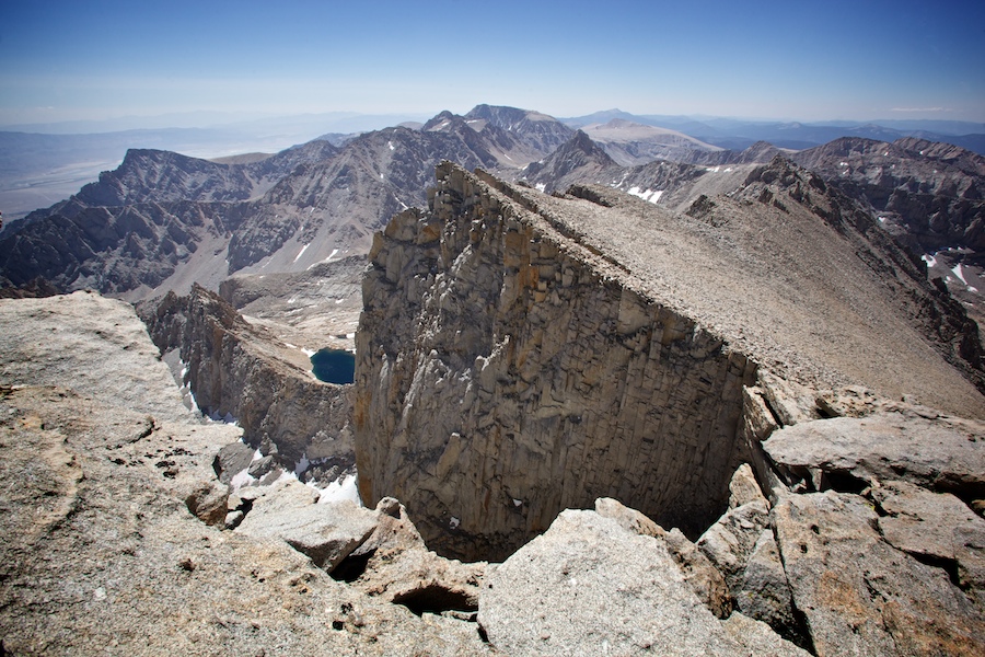
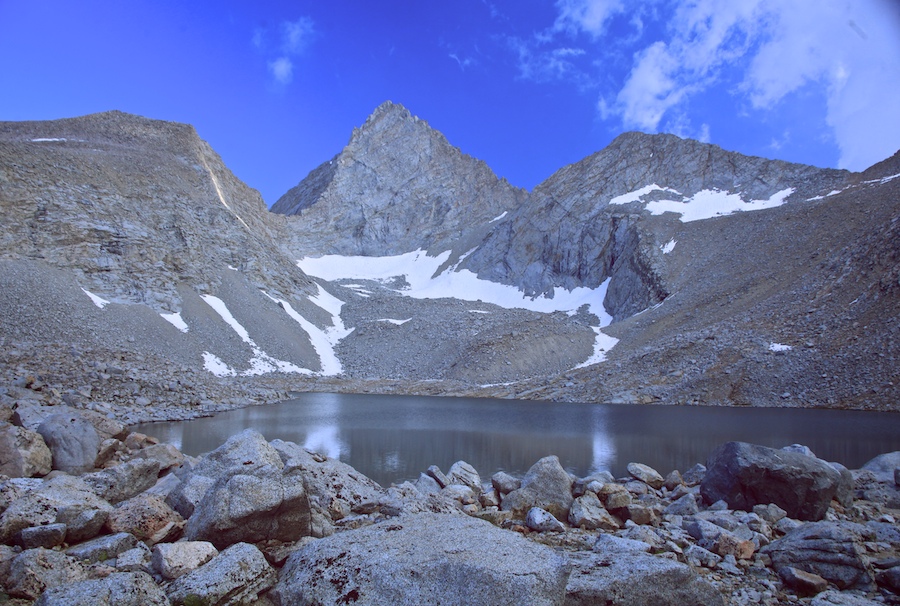
Crossing the strange prelude to the end...believe it or not, that peak on the left in Whitney, the highest in the lower 48. And that's where that trail leads, right up to that prow.
-llg

And there you have it, all up in that title.
-llg

Saturday, August 7th, 20th Day on Trail. Much better today. Forester Pass, despite yesterday's absolute beat-down, went out like a bitch this morning. As usual, got up at 5:00, but had black beans and rice on tortillas for breakfast, which really helped. Made short work of the one-mile, 1000 ft climb as the sun rose. Pass was in a strange spot, not an obvious one, and probably not possible without some major trail engineering and building, done long, long ago to make it like it is. Once again, dropped into a whole other valley, like a new place every time. This one rolled down nicely, once we got off the crazy steep headwall of the pass switchbacks.


Ease of miles, and a good breakfast, and we had already decided to go all the way to Guitar Lake, previously a two-day plan, 17+ miles. The lack of passes and overall rolliness of the terrain made the miles relatively easy. Came upon Cookie as he was packing up camp a mile or so beyond the pass, a fun reunion. He still liked the idea of a sunrise summit for Whitney, and I figured if the group was into it, we would go for it too at this point. He also spoke of hotels and a 'proper' beer, which has got me even more jazzed about finishing earlier. I'm hungry and feeling quite beat, the feet are aching, and my hands look like I'm mining coal all day. Broken toe is doing fine, as it has the whole time, and red right ankle hasn't made a peep in a long while now, a week or more. Most aches are just the normal hiking pains, but it makes me wonder how in the hell I did this for so long back in 2001! Must have just thought I was invincible, and wanted to prove it. I also got quite a bit more TOWN TIME in on the AT, and that's definitely what we're pining for, real food and beer, and a shower. Of note, I still sleep quite well in the tent.

After meeting Cookie, we pulled ahead and eventually stopped at a creek for lunch, after crossing the strange and barren landscape of Bighorn Plateau. Tres Penitos and Cookie Monster joined us at lunch, then we hiked out the final 7.5 miles to Guitar Lake. Picked up Wag Bags on the way in. Will be amusing to hike with my own poop for a day.

At Guitar Lake, Sunrise and Laughing Cloud were eating and we joined them. They hadn't planned on the 1 am start for a summit sunrise, so the group debated the rise time. We all wanted to summit together, but opinions differed on the sunrise part. The clouds were rolling in hard all around us, looking ominous, and that decided the rise time for us, 5 am, with rain being the sleep-in contingent. The rain question still remains as I write this in bed, as does the journey beyond Whitney, whether or not to press pass Trail Camp and on down to Whitney Portal or even to town, a hitch beyond the end of trail. Glad to be back with the crew for one last hurrah!

What's a group of Marmots called? This is unconfirmed, but my sources say it's called a SPRAWL. Now, according to one of my most reputable sources (he's on the lower left in black), a group of hikers is called a WAFT.
-llg

Another mid-trail panoramic for you to zoom in on by clicking.
-llg
That's what they call it. It's really at 12,250 feet, but who's counting? Not me, man.
-llg